
Members:- Siddharth, Ananya, Ankit
Sira:
Places of Historical Importance:

1. Kasturi Rangappa Nayaka Fort
2. Mallik Rehan 'dargah'
3. Juma or Jamia Masjid
4. Bada (the big) Eidgah
5. Tipu Sultan Fort
6. Khan Bagh
7. Ibrahim Rauza
Sira Today:
Places of Interest:
Sira:
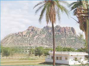
Sira was politically and militarily an important region of south India prior to the British Raj. The province was initially ruled by the Bijapur kings but came under the Mughal Empire 1687. It was later taken over by the Marathas for a short period until it declared independence under Hiader Ali's governance. In 1766 the province was lost to the Marathas until 1774 when Tipu Sultan captured it back.
Places of Historical Importance:

1. Kasturi Rangappa Nayaka Fort
2. Mallik Rehan 'dargah'
3. Juma or Jamia Masjid
4. Bada (the big) Eidgah
5. Tipu Sultan Fort
6. Khan Bagh
7. Ibrahim Rauza
Sira Today:
Sira ULB Contains 31 Wards and equal number of Councilors.The population of the Sira City is 50,088 as per Census 2001.The total area of the City is 17.57 sq.kms.It is located 50 km form the district head quarters and at a distance of 120 kms from Bangalore, the State Capital. The City has been an advantage of being along the National Highway No. 4. There is no railway station and the nearest is at Tumkur. The Sira Taluk is bounded on North by the Hiriyur Taluk of Chitradurga district, on the South by the Tumkur Taluk, on the East by the Madakasira Taluk of Andhra Pradesh State and Madhugiri Taluk of Karnataka State, on the West by the Chikkanayakanahally Taluk.
Chikkanayakana Halli:
The town is named after Chikkanayaka, a chief of Hagalavadi. The town was plundered and the fort was destroyed by the Marathas under Parashuram Bahu. The town is famous for cotton clothes white and coloured, and kamblis manufactured here are largely sold at the weekly fair.
 Chiknayakanhalli is Main Town for the Chiknayakanhalli Taluk . Chiknayakanhalli is 67 km distance from its District Main City Tumkur . And 132 km distance from its State Main City Bangalor. Other villages in Chiknayakanhalli Taluk are Kuppur , Mathighatta , Muddenahalli , Ramanahalli , Shettykere , Timmalaapura. Near By Villages of this Village with distance are Honnebagi(3.1 k.m.) ,Godekere(6.6 k.m.),Biligere(11.2 k.m.) ,Kondli(13 k.m.) ,Kandikere(14 k.m.). Near By towns are Chiknayakanhalli(3.2 k.m.) ,Tiptur(22.6 k.m.) ,Turuvekere(30.3 k.m.) ,Gubbi(35.4 k.m.)

Places of Interest:
1. The Venkataramana temple
2. Haleyuru Anjaneya Temple and Brahmapuri AnjaneyaTemple
3. Tatayyana Gori
Pavagada:
 Pavagada is a panchayat town in Tumkur district in the Indian state of Karnataka. Historically it was part of Mysore kingdom. Though it is geographically connected to Chitradurga district inside state of Karnataka, it comes under Tumkur district. It is 150km from state capital of Bangalore and Uttara Pinakini river flows in this Taluk.

Pavagada had a population of 28,036. Under this jurisdiction there are 33 Grampanchayath.
Places of Interest:
1. Pavagada Fort
2. Temple of God Shani
thank you ananya
ReplyDelete